Discovering the wonders of Tumbler Ridge, BC
As I write this post on Sunday, May 1st, I’m camped in the wilderness an hour west of Williams Lake, with no cell, no Internet – not even any radio stations. I won’t have Internet access to post this until I reach Bella Coola on Tuesday or Wednesday.
It’s been an amazing trip so far, and this is only Day 8! The 28 hours or so in Tumbler Ridge was both surprising and overwhelming – surprising because I hadn’t done any research, but neither do I recall hearing any news reports about the dinosaur-related finds in the area that resulted in the creation of the world-class Tumbler Ridge World Geopark. A geopark is an area with geologic heritage of international significance, designated by the Global Geoparks Network and supported by UNESCO. Tumbler Ridge is one of only 2 in North America.
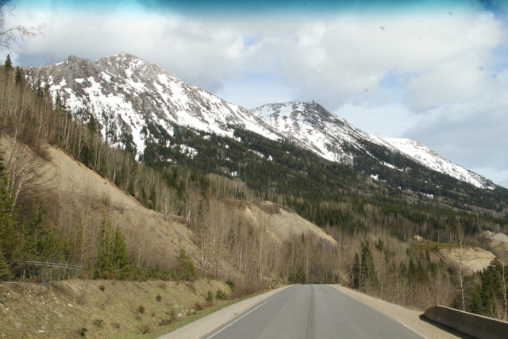
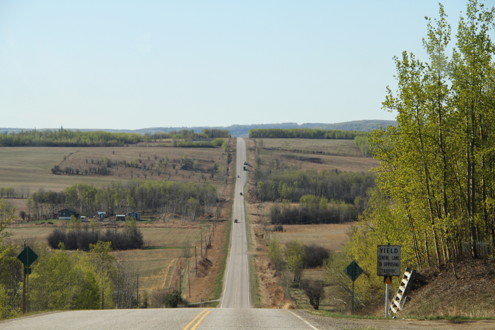
We pulled away from Dawson Creek at about 9:30 on Thursday. Tumbler Ridge is only 117 km (72 mi) away via Highways 97 and 52, and I thought that a full day and the following morning would give me a good look at the area (then came the surprise!). The scenery along Highway 52 is very pretty, and there are lots of ups and downs as it crosses valleys and ridges.
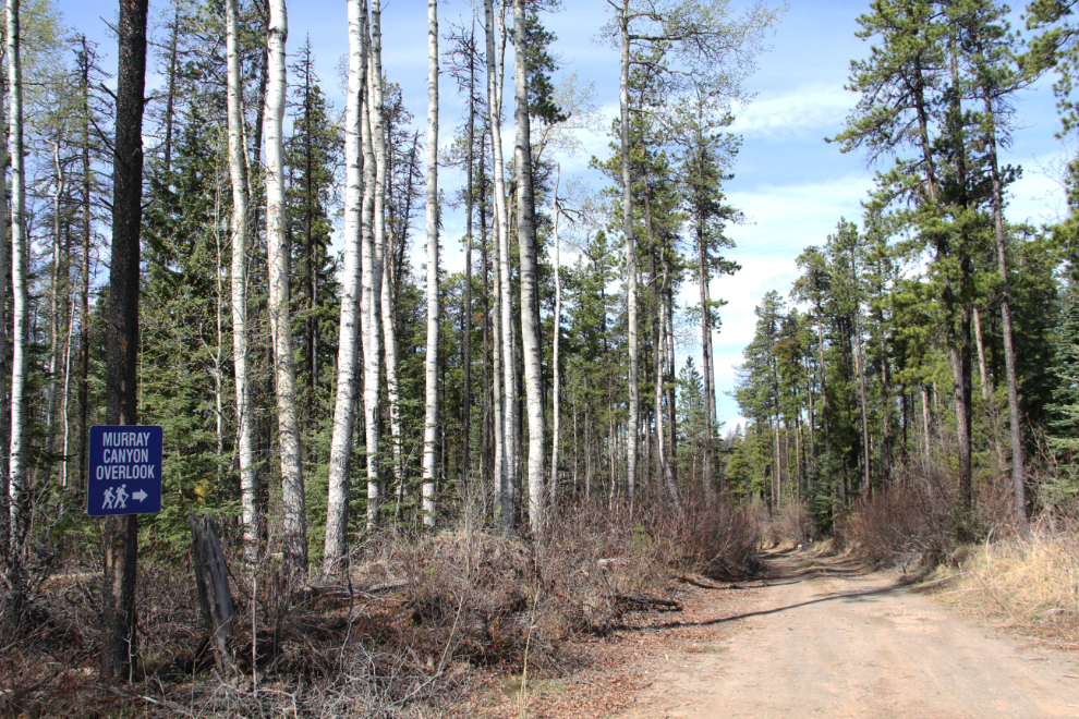
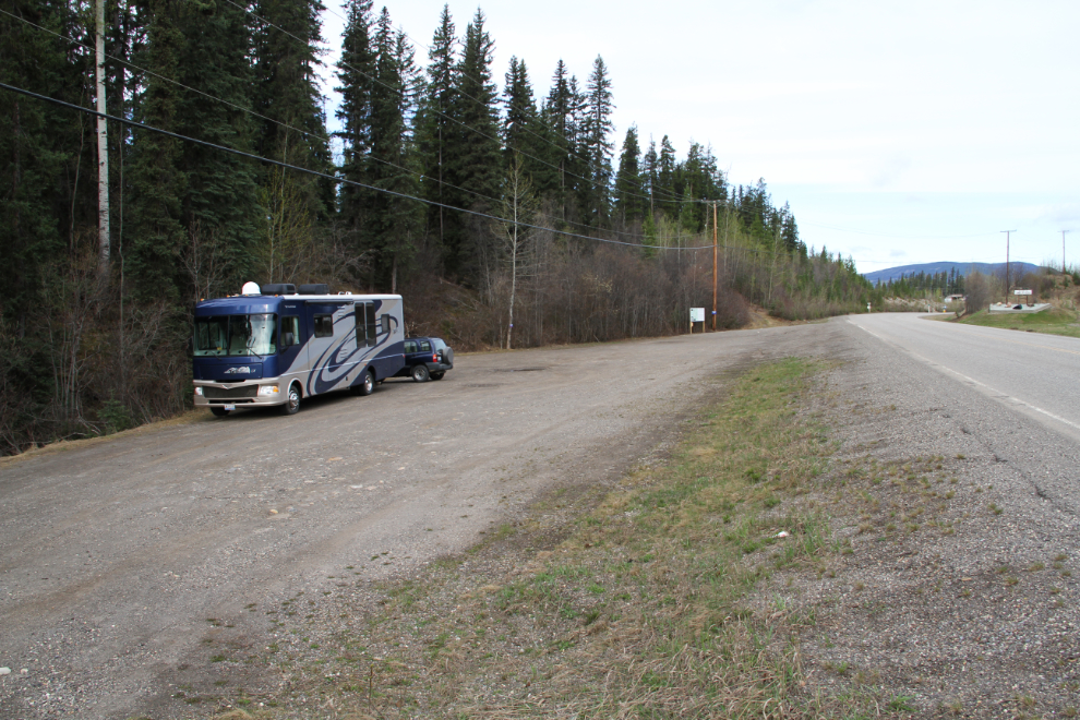
I was in no hurry so when I saw a sign for the Murray Canyon Overlook, I made the turn. With a rig that’s 51 feet long that can get you into trouble, and the little gravel road I turned onto had that potential. But there was a big turnaround at the end (a gravel pit), so no problem. The side road to the trailhead was too small, though, so I parked and the dogs and I walked the 700 or so meters/yards to it. A brochure at the trailhead said that it was a 5.5-km, 2-hour hike, and I wasn’t into that at this point, but it was a very nice walk.
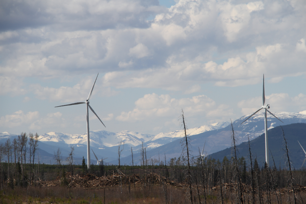
First surprise – a wind farm, larger than the one at Dawson Creek, with perhaps 60 turbines, though smaller than those at Bear Mountain. I have no information about them yet.
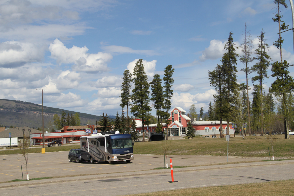
I had a hell of a time finding the Visitor Information Centre in Tumbler Ridge – there’s no sign on the building, and the little “i” flag was hidden behind some road construction trucks that blocked access to the parking lot as well. This is the view from the centre to the Town Hall.
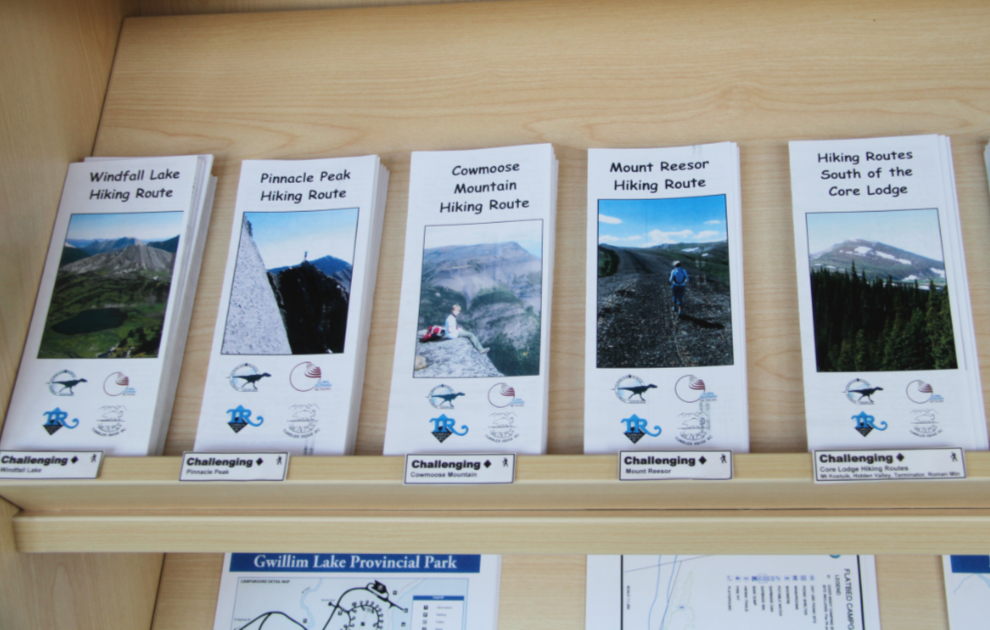
This is where the big surprise arrived – there are 47 marked hiking trails (250 km of them), there are 30 waterfalls of note, and the geopark has 43 sites! Okay, so one day won’t be enough 🙂
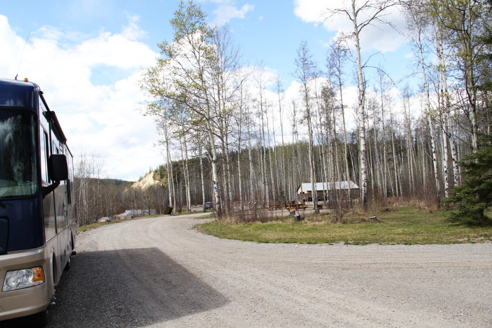
The first order of business was to get a camping spot and unhook the Tracker to go exploring. The woman at the Visitor Information Centre sent me to the Lions Flatbed Campground, and, seen below, it was perfect. I got all set up and then went looking for the manager. No luck, but I did find a guy working with a Bobcat, and he said that the campground was closed for a couple of weeks yet, and he would have locked the gate when he left! There’s a full-service campground run by the town but I didn’t need services, so I hooked the Tracker up again and moved to the large trailhead parking lot for the trail to the dinosaur trackway.
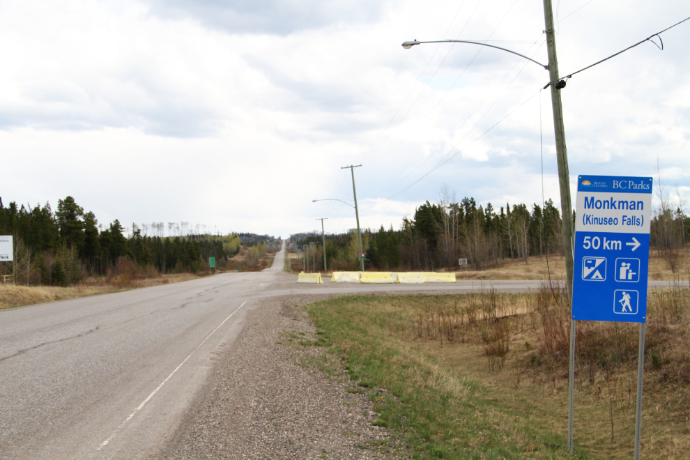
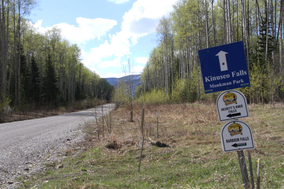
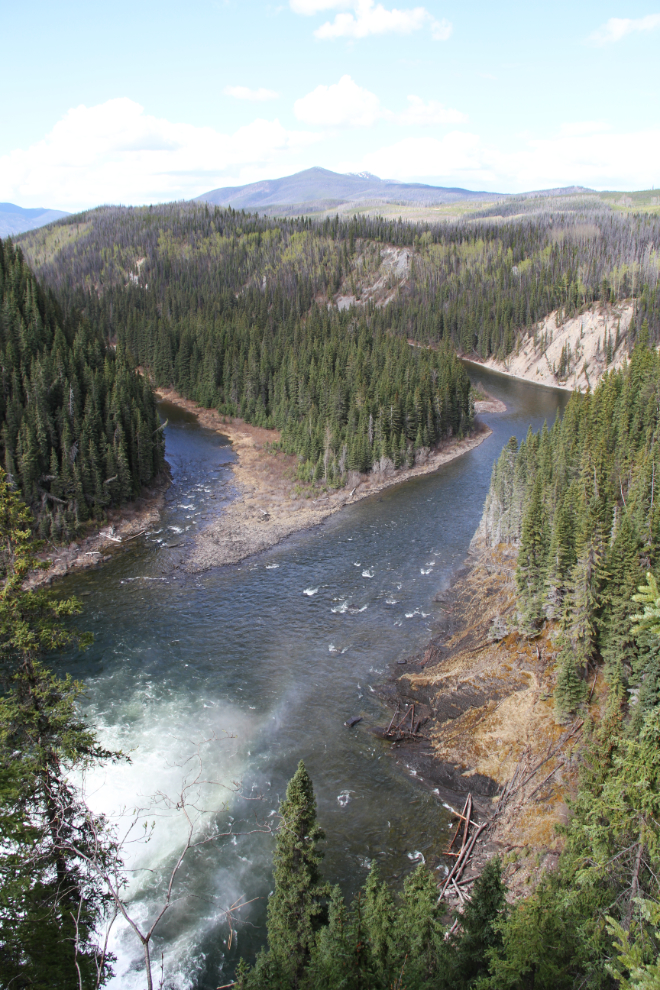
All set up now, I headed for Kinuseo Falls, the largest waterfall in the area. It’s 65 km from town, starting on Hwy 52E, the Monkman Pass Memorial Driving Route. It runs to Beaverlodge, Alberta, and isn’t even shown on most maps. Looks like a fabulous drive for the next trip. The intersection in the next photo is 12.8 km from the access road from the highway into town.
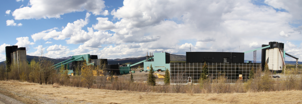
This panoramic shot shows the massive Quintette Coal operation, which is now in “maintenance mode” – closed until world prices improve. Coal was discovered in the late 1970s, Tumbler Ridge was founded, and in 1983 the Quintette and Bullmoose mines started shipping. The population of Tumbler Ridge peaked then at about 5,000.
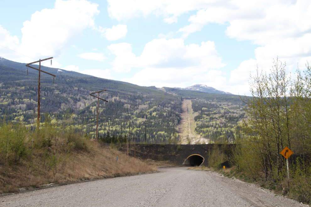
The road, the Murray River Forest Service Road, goes through two tunnels under coal-haul roads.
The route to Kinuseo Falls is well marked, but several other waterfalls try to catch your attention. “Kinuseo” is “fish” in the Cree language.
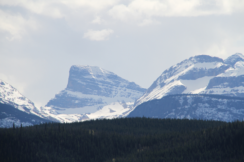
There are some very impressive mountains in the backcountry, some of which is protected by Monkman Provincial Park.
From the parking lot, it’s a short walk (150 meters/yards) to the lip of the falls, which gives this view down the Murray River valley.
The main viewpoint offers this view. I met 3 people from Alberta there, one of whom was about to launch his drone to shoot the falls – yes, a superb spot for that.
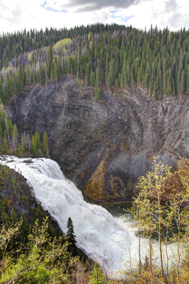
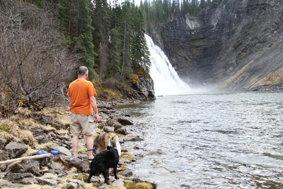
We continued on the trail another kilometer or so, to the river. At lower water levels, a full view of the falls can be seen.
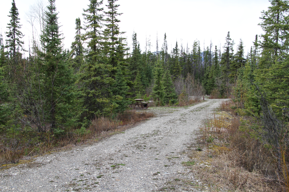
Before heading back to town, I detoured for a look at the Monkman Campground. It’s quite nice, but seems to get very little use. There are 22 sites, with 5 pull-throughs, which are quite funny, as they’re about 200 feet long!
Our camping spot for Thursday night.
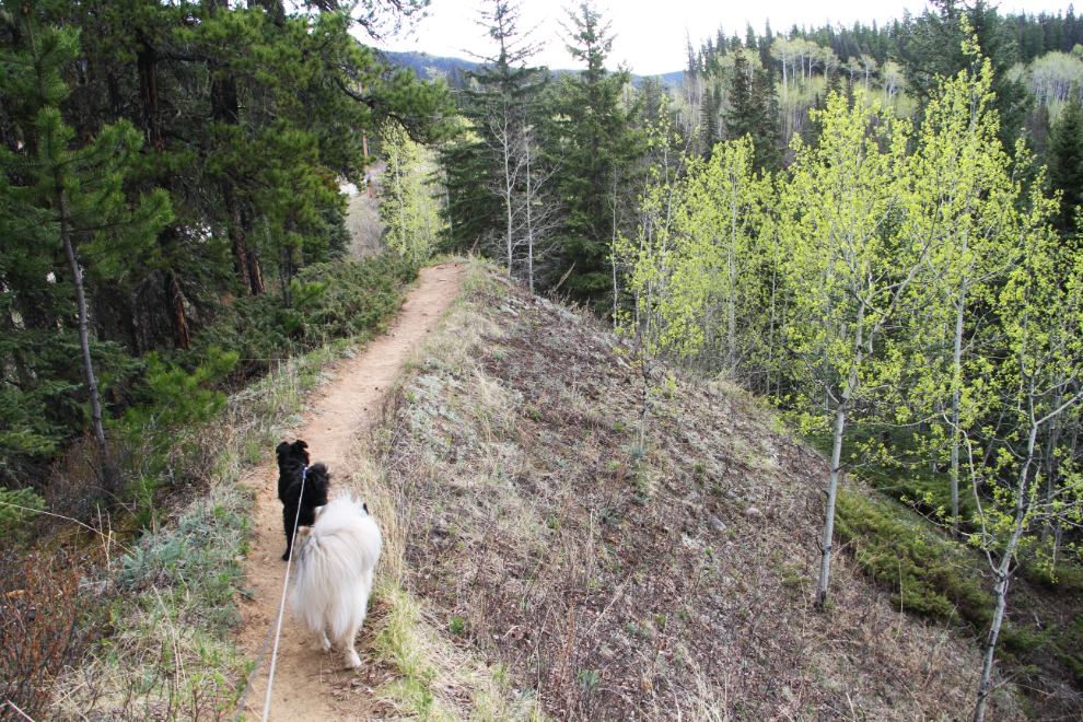
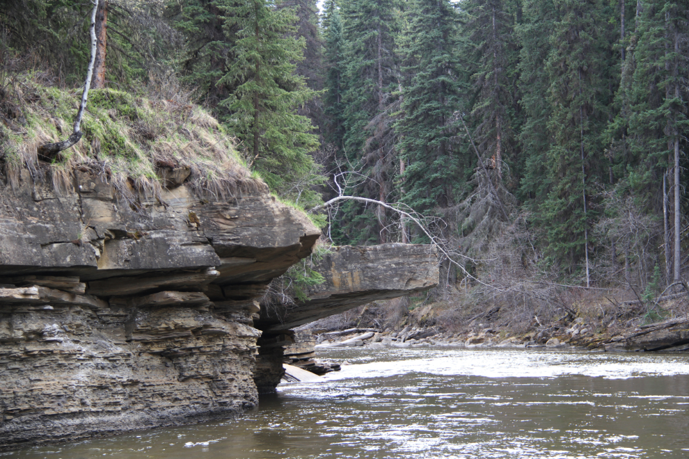
On Friday morning, we started off on our first hike, on a network of trails that included waterfalls, pools, and the dinosaur trackway. It starts off on the most impressive esker I’ve ever seen – that’s about a 50-meter drop on the right side.
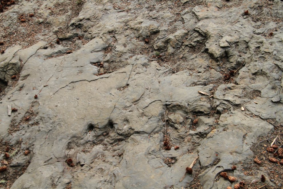
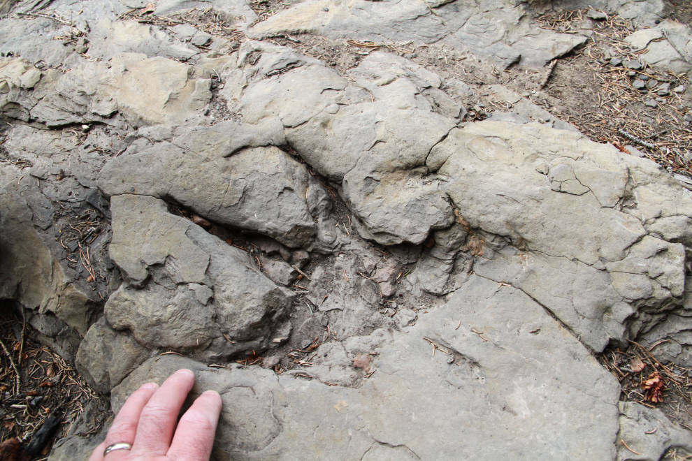
The dinosaur trackway on Flatbed Creek is pretty amazing. The first trackway discovery, just downstream from here, was made in 2000 by a couple of local boys floating down the creek on inner tubes, and several others have now been made. The prints of theropods, ornithopods, and anklyosaurs are all visible.
Bella and Tucker were having a ball!
A particularly fine theropod print, with a dewclaw as well as the three toes.
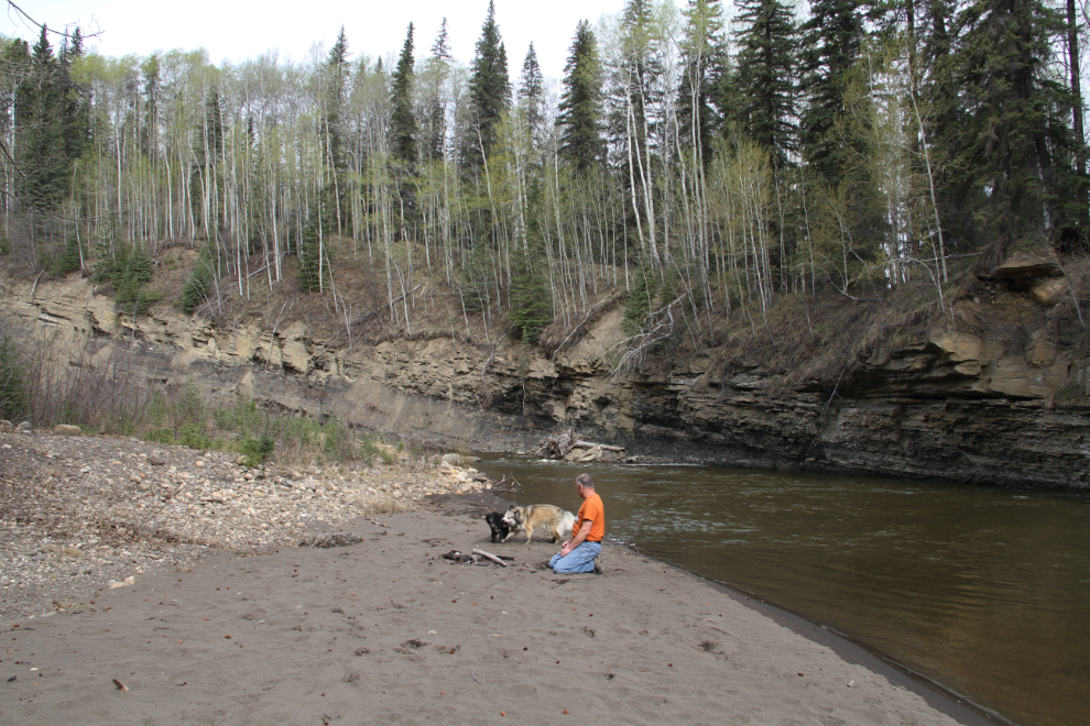
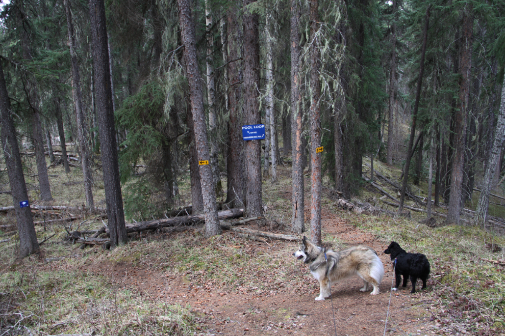
Back up on the ridge, we took a detour around Pool Loop. Overhanging Rock Pool looks like it would be a fabulous spot on a hot summer day. There’s a trail down to one of the sandstone ledges that’s obviously for jumping into the creek.
The sandy beach at Overhanging Rock Pool was also the perfect place to “unleash the hounds”, and they went crazy, tearing around like maniacs until I called several minutes later and they obligingly got leashed again.
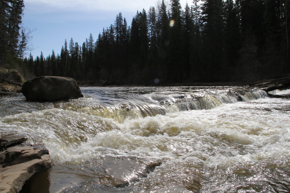
Mini Falls may be tiny but it’s a beautiful spot, with a huge overhanging sandstone slab on the far side.
Looking back down the trail as we were heading back to the motorhome to consider our next hike. Just 3-4 minutes later, though, the day got much more interesting than any of us would have liked.
I saw a black bear about 100 yards ahead, well off the trail and walking away from it. I shortened the dogs’ leashes up and backed up about 50 feet so we were behind a low rise, out of sight of the bear, to wait a few minutes until he/she had moved on. I took my bear spray out of my pocket, though, and slid off the trigger guard. A few seconds later, the bear came over the low rise and all my yelling and the dogs’ barking had no effect on its approach except possibly to speed it up. I fired the pepper spray, and when the bear hit that cloud a fraction of a second later, changed his mind, wheeled around and ran back up the trail.
What the hell??? The bear had doubled back and come down the trail to find us. No warning noise, just an attack. That is not normal black bear behaviour (I’ve been bluff-charged by black bears – in southern BC – twice before). Fifty-plus years hiking in bear country, and that’s the first time I’ve ever had to use bear spray.
Continuing our walk, Bella was nervous, but Tucker was traumatized. A squirrel ran across the trail a few minutes later – Tucker screamed (that’s the only term that fits the noise he made), ran as far back down the trail as his leash would allow, and that was it, his hike was over!! I thought I was going to have to carry him back to the rig, but I knelt down, cuddled and comforted him for a couple of minutes, and life was okay again.
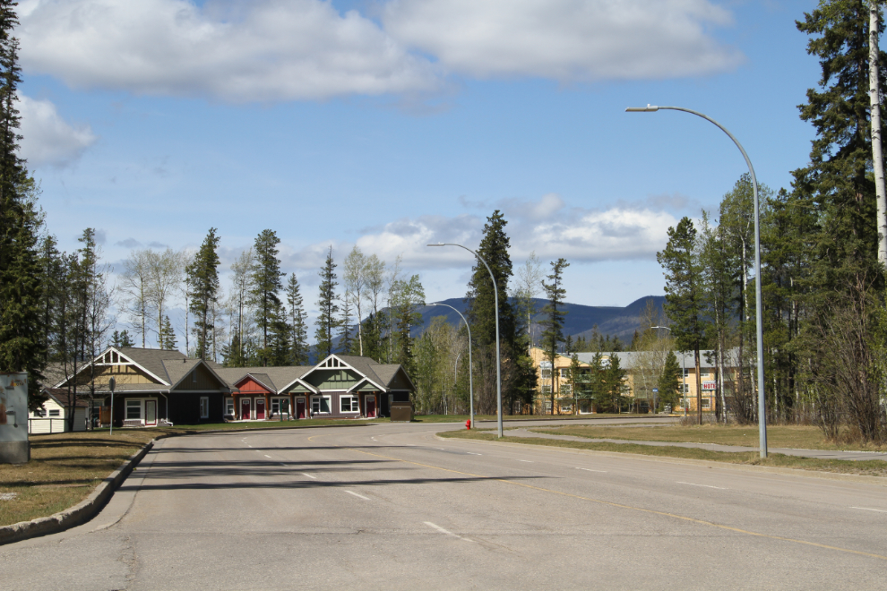
Okay, back to Tumbler Ridge, to tell the woman at the Visitor Information Centre that the sign at the trailhead was correct – there is indeed a bear in the area, and he/she is in a really dirty mood. She asked me to tell the manager at the Dinosaur Discovery Gallery, where I was going next, and this photo of a particularly nice residential area was shot on the way.
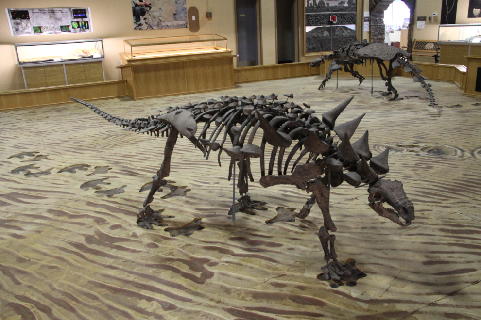
The Dinosaur Discovery Gallery is excellent – truly a must-see to help you understand what you’re seeing out on some of the trails. This is the armoured polacanthin anklyosaur that made many of the tracks 110 million years ago.
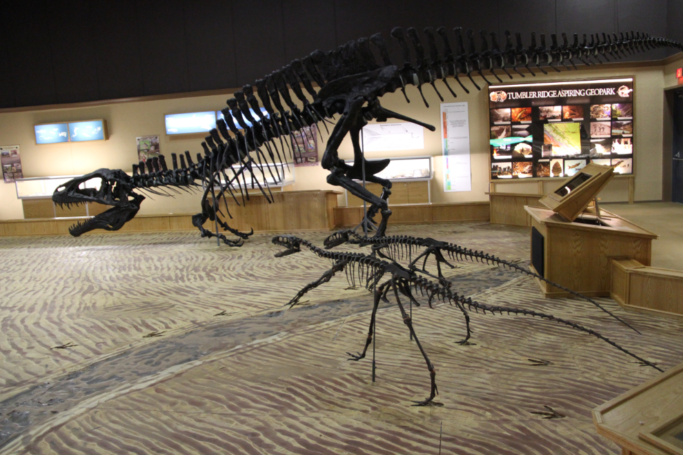
The theropods are smaller than I expected from the prints. That’s Acrocanthasaurus, rather like a small Tyrannosaurus Rex, in the back.
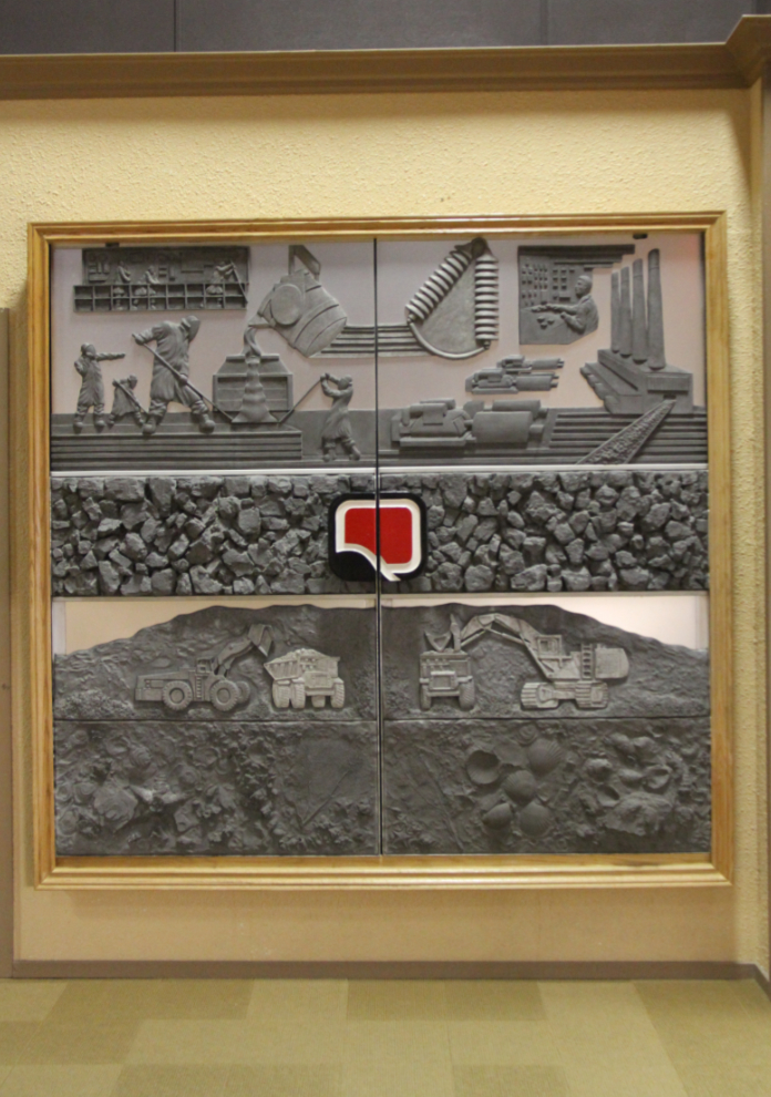
The beautiful doors were removed from the administration building at the Quintette mine in 2001 (that’s the black-glass building towards the right of the panorama near the start of this article). They ended up in a museum in southern BC, but in 2013, were repatriated to Tumbler Ridge and are now in the Dinosaur Discovery Gallery.
Before I left the gallery, the manager had phoned a friend who phoned me and then the regional Conservation Officer in Dawson Creek, who then called me for much more information about the bear conflict. He said that he’d be driving to Tumbler Ridge to check it out. While non-commital, I think that he too felt that it was predatory, and so a serious problem.
We left Tumbler Ridge just after 2:00 pm, and by 5 were in Pine Pass, seen below, now planning to camp somewhere north of Prince George rather than at an RV park in town as had been the draft plan. After seeing that the area’s provincial parks were not only closed but gated, I stopped at the huge and empty Crooked River Rest Area, right beside the Crooked River about an hour north of Prince George.